On Monday afternoon I received an email from Paula Smail, Friends of Virgin Islands National Park Outreach Director:
“We are doing a test run on the guided Reef Bay Hike tomorrow and we have room for you if you would like to tag along.”
My answer was YES. Absolutely! For those of you not familiar with this amazing expedition led by Virgin Islands National Park Service Rangers and Friends staffers, it has literally just started again with public tours beginning next week on Mondays and Tuesdays. It is an extremely informative guided hike through some of the tallest trees on island and down the 2.6 mile traverse from Centerline Road to the Reef Bay Sugar Factory with a boat ride back to town as the grand finale. And it was one of the most amazingly informative and entertaining things I have done on St. John (yes, even I learned a lot!).
First thing’s first, before I get into the photo tour…yesterday’s training hike was led by NPS Ranger Mark Whitefoot and the group consisted of Friends staff and volunteers, a member of the Iowa State University team that is currently working on the mangrove restoration near Annaberg and a National Park Service Archeologist. Well, and me 🙂 Hikes in the future will be guided by either an NPS Ranger, Friends Program Coordinator, Mark Gestwicki (AKA Mark from the Park) or Friends Trail Manager Taylor White. Taylor and Mark G. both came along on this training and monitoring expedition in order to gain more knowledge but also provide their own insights to Ranger Mark’s crazy amount of knowledge of this area of St. John that is vastly important to the island’s history.
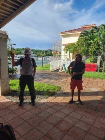
The tour began at the National Park Building just next to the playground in Cruz Bay. A group consisting of several Friends volunteers who were staying at the Cinnamon Bay volunteer camp, Friends staffers Taylor, Mark, Alliyah Hodge and Ameir Sprauve, NPS Ranger Mark and myself. The infamous bearded taxi driver, Chico, met us there with his bright yellow safari as we gathered under the picnic pavilion to avoid the light rain. I thought to myself that the rain lingering from the downpours the night before would probably lend to a spectacular show at the waterfall later in the day…
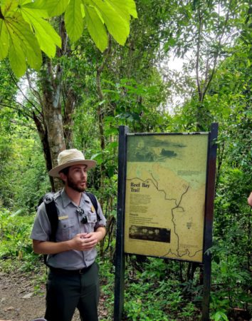
At the Reef Bay Trail head, we exited the cab, waved goodbye to Chico and gathered at the placard at the bottom of the stairs. Once everyone had assembled, Ranger Mark gave us the rundown on steering clear of the brush in order to avoid treacherous plants (Christmas Bush), wasps (Jack Spaniards) and orb spiders. All of which we saw examples of by the day’s end. He also warned to watch our steps on the wet terrain on the way down. Words to hold on to 😉
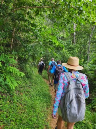
On the way down the trail, we stopped every five to ten minutes in order for the Marks and Taylor to give valuable insight on plants and trees and the cultural and natural artifacts that we encountered along the way.
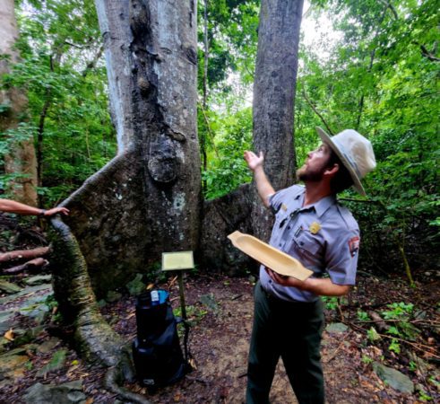
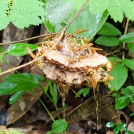
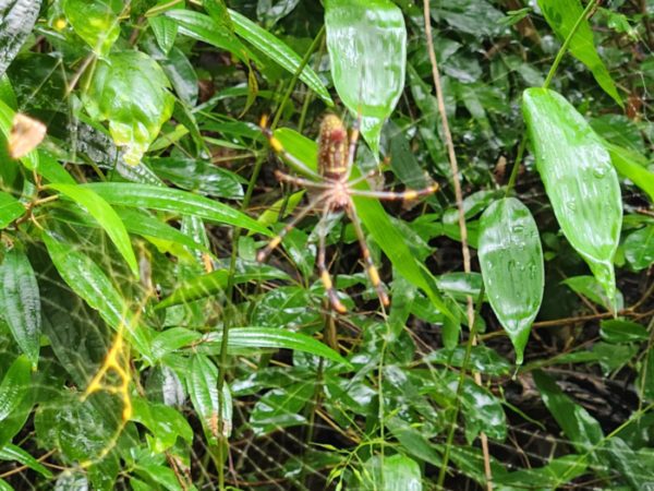
I really don’t want to ruin the informational surprises on this hike for all of you who plan to do it in the future. So I’m skimming through the many details that were shared with our group by the guides. However, I will get into a little of the history stuff.
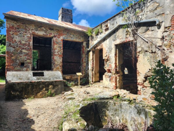
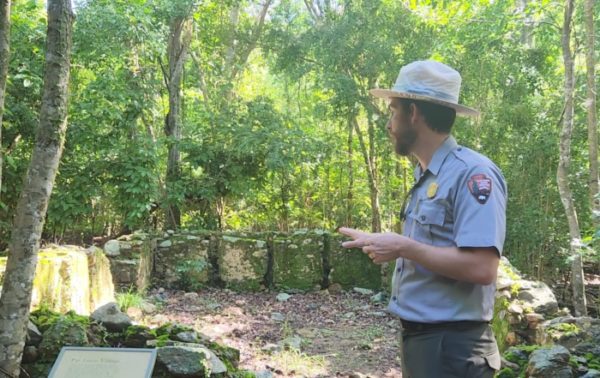
The first ruins that you’ll happen upon on your way down (on the right) were once a part of the Josie Gut Plantation. Ranger Mark told us that most of the sugar production sites that we see today didn’t necessarily start that way. It took a lot of capital to build something that large and many of the larger production sites started small with crops like cotton and coffee or livestock in order to build up the money to expand into larger operations.
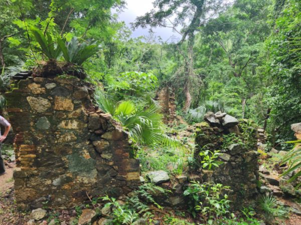
As you are descending the rocky trail, you’ll also notice rock walls throughout the terrain. These rock walls were actually constructed in order to regulate livestock, keeping the animals away from the crops and/or in a contained area. It’s a little known fact ouside of St. John history buffs and the local population that the Marsh family once owned and operated the land in the Reef Bay valley. The emancipation of enslaved people and the overworking of the land led to a decline in sugar production over the years. And in the early to mid 1900’s, Anna Marsh, the last resident of Reef Bay, likely relied on raising livestock and harvesting fruit for her livelihood.
The next ruins you’ll happen upon are a bit quizzical, according to Ranger Mark. Because of the various eras of architectural elements found within the small cluster of still standing foundations (known as Par Force Village), it is difficult to know when exactly they were constructed. But it is likely that they were utilized both before and after the emancipation in 1848.
The next stop of note was the Petroglyphs, a short quarter of a mile hike off the main trail. As we got closer and had to traverse a creek where a dusty trail generally exists, we knew there would be a waterfall waiting for us upon arrival at the Petroglyphs pools….
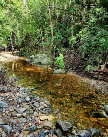
And we were absolutely correct!
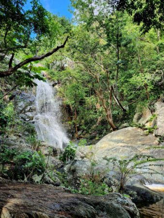
I’m not going to bore you with my synopsis and stumbling translation of Ranger Mark’s historical account and the meaning behind the petroglyphs. Instead, I’ll let you hear it for yourself. He is accompanied here by NPS Archaeologist, Brittany Mistretta who was also along for this training hike.
Interesting, huh? Pardon the sound of that LOUD and rushing waterfall 🙂
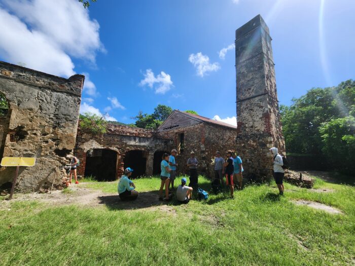
Our last stop before venturing over the hill to Genti Bay to catch our boat ride home was the Reef Bay Sugar Mill Ruins. This was one of the first plantations on St. John and one of the last to struggle through the end of the sugar production era. Again, I’m not going to give away the secrets of the tour.

But one thing of note that might not be covered in every guided hike is this…
Before my last visit to Reef Bay, I read the section of Off the Beaten Track that highlighted the area. In addition to a pretty thorough history of the land and the plantation, there was mention of a gravesite behind the mill. One very well preserved traditional above ground gravesite that marks the place of rest of W.H. Marsh. The last man to oversee the operations of the land as a plantation.
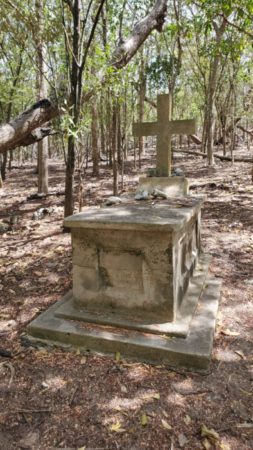
And I found Mr. Marsh’s gravesite without issue as I made my way through the brush. But the passage also notated that there were several unmarked graves in the area (two of which are supposedly his daughters) and I wandered around for a bit with a blind eye and probably too much curiosity, not knowing how to recognize these sacred tombs of those who had worked the land that I stood upon. So, yesterday, I struck up a conversation with Ranger Mark about whether or not he knew about these sites and how to recognize them.
“Yes,” he said as we walked, “And it is actually very important that everyone knows how to recognize them.”
You see, on many of the estates of St. John where enslaved people made up more than 90% of the population at times, these burial sites are marked not with an astute headstone or a cross made out of sticks, long weathered by the elements. But by non-descript arrangements of rocks. To the unassuming eye, they may be mistaken for just what they are: Rocks. But in many areas, these burial sites, most of which likely belong to once enslaved individuals, are marked with rock formations that at one point in time may have been arranged a bit more tightly. But as time weathers all, they seem now to be disheveled piles without meaning.

The takeaway on this is if you ever come across one of these formations, do not touch it, do not disturb it. Chances are the ground you are standing on is likely sacred and an important piece of someone else’s history.
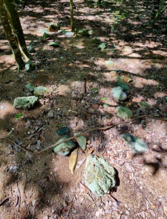
And I think that is something that is important for all of us to remember as we enjoy these historical lands, rich with beauty yet shaded by a dark past…Tread lightly, be respectful and learn all that we can about the land we stand upon. I fall more in love with St. John every time I learn more about her. Because there are so many stories to be told here. Dark ones and inspiring ones and ones that are yet to have a definitive end…or beginning for that matter.
Mark and I headed back towards the rest of the group who were waiting in the shade on the other side of the factory before ascending the only true incline of the day. We headed back out on the L’Esperance Trail and stayed to the left to get to Genti Bay (about a ten minute up and then downhill scramble) where we arrived on the beach just in time to see the boat, known lovingly as the Sadie Sea, approaching one of two mooring balls in the bay.
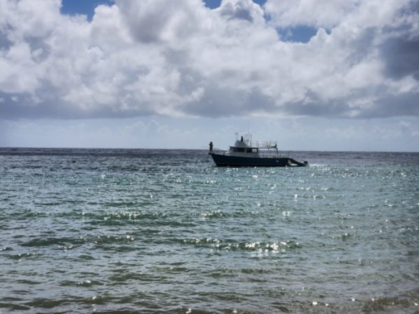
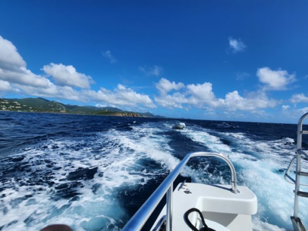
Two dinghy rides later, the whole gang was on board and headed back towards Cruz Bay with Captain Abbie from Wharfside Watersports.
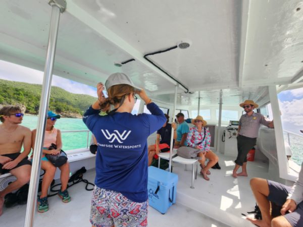
Ok, so this hike is every Monday and Tuesday, beginning this coming week. The meet up is at NPS dock at 8:30AM and you should plan to be gone until about 2PM. Wear sturdy shoes and bring bug spray, reef safe sunscreen and at least two liters of water per person in your party. Snacks would be good too as I was a bit hangry by the end of the hike. Another thing I totally spaced on: Flip flops for after the hike! I know…Rookie move 🙂
There is limited space on these amazing, guided hikes; absent only of the two-and-a-half-mile ascent back to Centerline Road finale. HA! So, if you are interested in hiking Reef Bay, learning a TON about St. John and enjoying a boat ride, not an uphill hike, at the end of your journey, you should sign up today! The hike is $75 per person, payable via your registration on the Friends VINP website. Oh, and if you’re interested in this perfect combination of St. John scenery, nature and history, I would highly recommend checking out the Leinster Bay and Ram Head guided hikes as well. Those will be my next ventures. And you will absolutely hear all about it. 🙂 Happy hiking!


Thanks for the information. I can’t wait to take this hike again! Signed up for January. The price is different than what your mentioned. We paid $159 for two.
Yes that was what we paid as well.
Thanks Hillary for sharing. My wife and I used to take this hike every time we visited STJ. They were then often led by long time resident Ranger Don Near. We always looked forward to it and were even able to take our son once before they were discontinued. They are super informative and a cherished memory. I am thankful that more visitors will now have this opportunity. We are headed down in the next couple weeks and are already signed up to go and see the amazing sites and learn more history and facts about this wonderful place.
Thanks for sharing this!!!
I did this hike probably 40 years ago, and still remember the interesting stories the ranger shared. So glad to see it is reinstated……but, I’m pretty sure it was free when I went. Thanks for the great article, as always. Cheers from St. Croix.