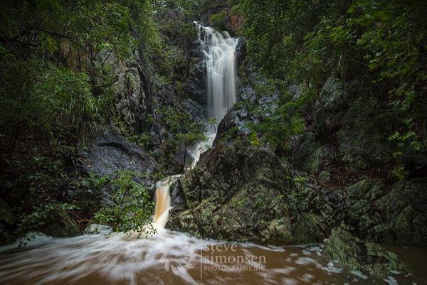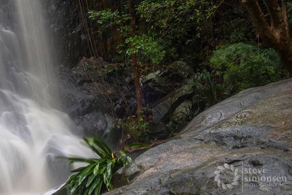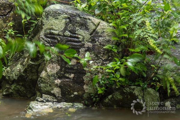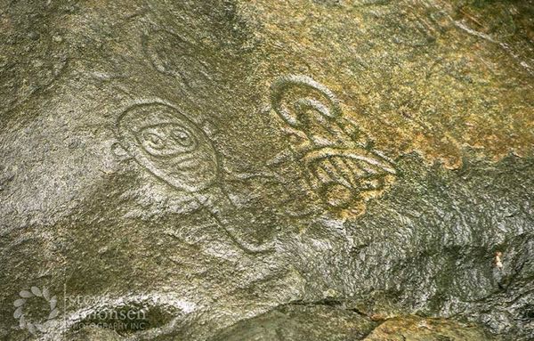
For those of you who’ve been following the news here on St. John this week, you know that we had a pretty intense storm Monday and into early Tuesday. Because of that, our island is extremely green and lush, and our cisterns are full to the brim. But it also means something else very cool happened … the waterfalls at Reef Bay have been flowing this week!
Steve and Janet Simonsen visited the area on Tuesday and took some amazing photos of the waterfalls and petroglyphs. For those of you unfamiliar with this area, here is some information from SeeStJohn.com, my go-to guide on everything St. John:
“In the lower section of the Reef Bay Valley, there is a fresh water pool fed by an intermittently flowing stream called the Living Gut. (Note from Jenn: the more it rains, the larger the stream, thus the larger the waterfalls are.) It is surrounded by large, smooth rocks onto which dozens of drawings and symbols have been carved. These rock carvings, as well as the pool itself, are known as the petroglyphs.
“High above the pool a waterfall cascades down a forty-foot cliff where strangler figs and wild orchids have taken root using cracks and crevices in the rock face as footholds.
“The fresh water provides an environment for shrimp, frogs, small fish, dragonflies and hummingbirds and at night bats zip back and forth above the pool searching for a cool drink.”
More details from SeeStJohn.com…
Who Carved the Petroglyphs
“An often-asked question by visitors is ‘Who carved the petroglyphs?’
“Although no one knows for certain, the most likely answer to this question is that the petroglyphs were created by the pre-Columbian inhabitants of St. John known as the Taino.
“Before the arrival of Christopher Columbus in 1492, and the subsequent annihilation of the native population, the Tainos inhabited the islands surrounding the Caribbean Sea. Archeological excavations, such as the one being conducted at Cinnamon Bay under the direction of National Park Archeologist Ken Wild, have shown that St. John was once a major settlement site of this society.
“One characteristic of Taino culture was the carving of petroglyphs in caves and along rivers, streams and rocky coastlines. Petroglyphs have not only been found on St. John, but also on many other islands formerly inhabited by the Taino such as Puerto Rico, Hispaniola, Cuba and the Bahamas.”
Pretty interesting, right? Now check out these pics that Steve Simonsen took this week:


The petroglyph trail is about 1.6 miles down from the Reef Bay trailhead at mile 5 on Centerline Road. It’s a small trail off to your right a bit before the sugar mill ruins. Coming up from the trail, it is about .8 miles on your left.
For those of you who’d like to visit the petroglyphs, but prefer not to hike back up the Reef Bay trail, you can opt to take a guided hike with the Virgin Islands National Park. The cost is $40 for a six-and-a-half hour trip. The hike begins at the Visitor’s Center where you will hop in a taxi to the Reef Bay trailhead. From there you will be guided down the trail and will learn about the history, flora and fauna. You will then be picked up by Captain Tom of the Sadie Sea and taken back to Cruz Bay by boat.
Click here for more information on the VI National Park’s guided hikes.


As always, amazing pix from Steve Simonsen. Love to see how much more distinct the petroglyphs are when the rocks are wet. Nice to see the waterfall running at capacity. Would like to see it in person sometime, as long as the trek down the trail isn’t any more arduous.
This is beautiful and is the natural way of this island, to have fresh waterfalls. Before tourism was popular and the money system took over, these islands were much more like a rainforest ecosystem. Now the chemtrails for weather control for the ‘destination tourist beach spots’ have changed everything. If you look in the sky after a few rainy days, you will clearly see the trails of chemicals that disperse the clouds.
I love Steves work. We will be on island in 47 days. Who’s counting?
Ms. Taylor.
47 days? That is at or near the end of September. “Closed” season. Do you know something we don’t? Just interested in how the island is during this time of the year.
thanks.
Wow! Great Photos!!
We usually do the hike with the park, what a great experience every time.
We’ve never done it on a rainy day, so never had the opportunity to see a waterfall there. Simply beautiful.
thanks for the photos and the article.
I love Steve’s work as well. We will be on island in 40 days. I’m counting!
Melanie, you obviously know nothing about either history or VI weather. The past 20 years have been generally above the long term average rainfall on St John, and records going back to at least the 1850s show no decline in averages. Clearing of a large amount of the original forest during the 1700s and early 1800s did lead to a loss of the organic material on the forrest floor that allowed rainfall to absorb into the aquifer rather than run off into the sea, so guts now flow for shorter period than they would have in the Taino era.