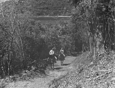
Last Thursday we shared a pretty cool picture over on our Facebook page. The picture (above) showed the North Shore Road in 1948.
According to the St. John Historical Society, “the picture was taken by Ronald Morrisette, and the women on horseback are his wife, Sarah Morrisette, left, and Helen Auble (Ms. Auble, a St Thomas resident for many years, gave the picture to [Island Resources Foundation] before her death in the late 1990s). The road is near the bottom of Hawksnest hill, in the distance is the Oppenheimer end of Gibney beach, then called Hawksnest beach. They were passing through the eastern side of the Caneel Bay property, which then stretched from the Creek in Cruz Bay to include the present National Park Hawksnest Beach.”
We found the picture to be so interesting that we sought out to find a few more that we could share all of you. We’d like to extend our thanks to David Whitney Knight, Sr. and Eleanor Gibney for sharing the following pictures with us.
Courtesy of David Whitney Knight, Sr.:
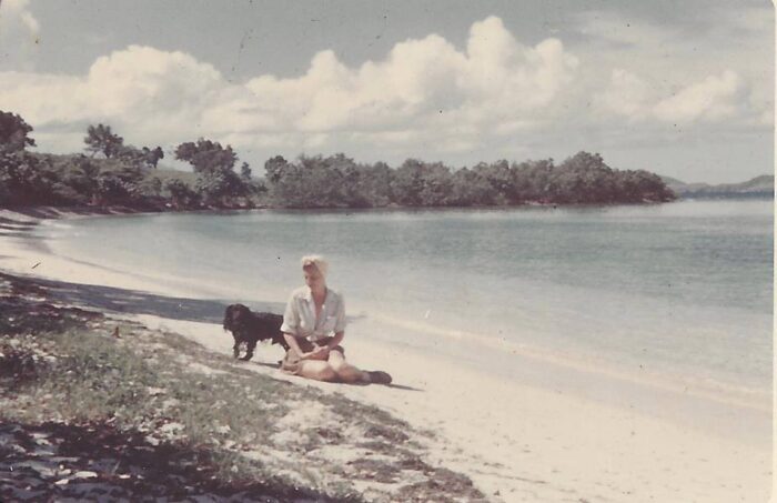
How many of you recognize the pristine beach shown in this picture? According to David Whitney Knight, Sr., it was taken c1949-1950. “The lady in the picture is my mother, Anna, with her dog Spooky; the photographer is my father, Dr. George H H Knight.”
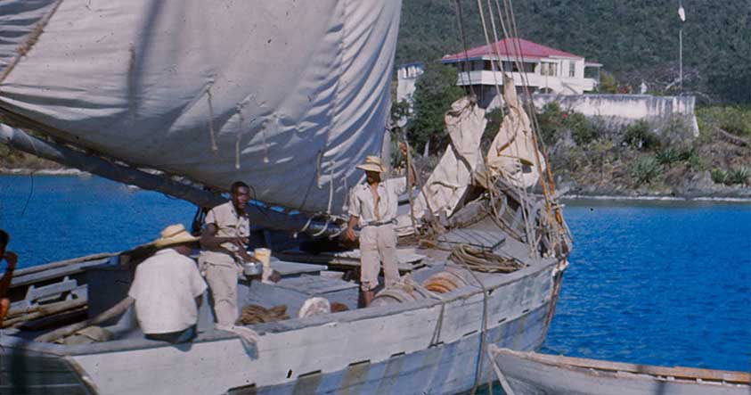
The following images are courtesy of Eleanor Gibney. The descriptions are courtesy of the St. John Historical Society.
“A locally-built cargo sloop lowers sail and prepares to come alongside the Cruz Bay dock, c 1959. Up until the 1970s Caribbean-built cargo vessels such as the “Baby Mac,” “Pride of Tortola” and “Miranda Stout,” were St. John’s primary link to the outside world, carrying everything from fuel oil and livestock to mail and passengers.”
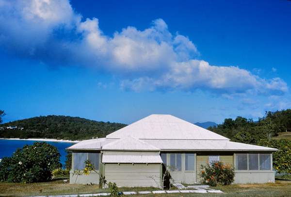
“Caneel Bay, 1959.
One of the original cottages from the late1930s on what is still called “Cottage Point” They were replaced in the early 1960s.”
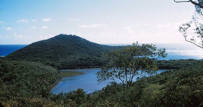
“The impact of modern development on St. John’s landscape becomes staggeringly apparent when you compare Chocolate Hole today with how it looked in the late 1950s (photographer unknown).”
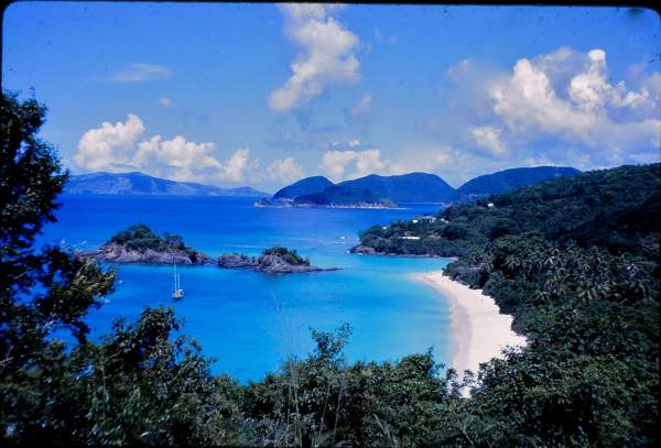
“The iconic Trunk Bay view–here in a slide by an unknown tourist in 1963. The main building of the former Boulon guesthouse is still very visible on the hill, where it was a popular lunch spot, run by Caneel Bay.”
Interested in learning about more of St. John’s history? Click here to visit the St. John Historical Society’s website.