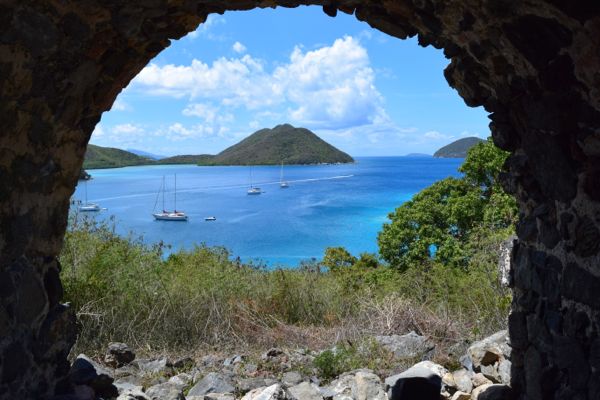
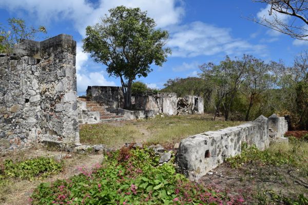
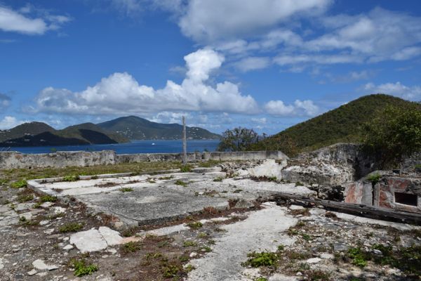
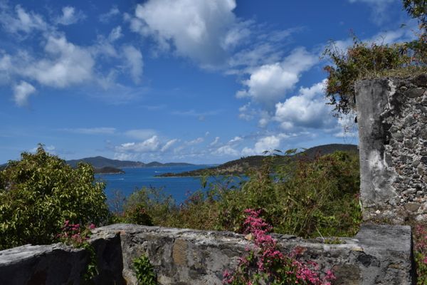
 How many of you have sat at Waterlemon Cay, looked up and noticed the set of ruins that sit high above the bay and wondered what the views were from way up there? I was one of this people for years, so earlier this week, I decided to go out and see them for myself … And I was simply blown away by what I discovered.
My goal Monday morning was to take a good hike, one I’ve never done before. So I drove out to Annaberg and walked the Leinster Trail out toward Waterlemon. The Leinster Trail begins right near the parking lot and winds along the shore. After about 10 minutes or so, you’ll hit the beach at Waterlemon. Just beyond that will be the trailhead for the Johnny Horn Trail. That’s where this awesome hike begins.
According to SeeStJohn.com, a super informative website created by Gerald Singer, the Johnny Horn was “named after Johan Horn who was second in command to Governor Gardelin in St. Thomas and Commandant of St. John around the time of the slave rebellion in 1733. He was the Chief Bookkeeper and Chief Merchant of the Danish West India and Guinea Company on St. Thomas. According to John Anderson in his historical novel, Night of the Silent Drums, Englishman John Charles, a former actor who became a small planter on St. John, said the following of Horn:
He had a grimace for a face, lies for eyes, noes for a nose, arse cheeks for face cheeks, fears for ears, whips for lips, dung for a tongue, and to all who knew him it seems strange that he has but one horn for a name.”
Hmmm, it doesn’t sound like Johan was well liked. Ok, but back to the trail…
Once you hit the Johnny Horn Trail, you’ll walk about 5-10 minutes up a steady incline until you reach an old Danish Guard House. According to See St. John, “this small fortification was built on this strategic location, called Leinster Point, because it overlooked two critical passages, the Fungi Passage, between Whistling Cay and Mary Point, and the Narrows, which separate Great Thatch and St. John. The guardhouse was equipped with cannons and manned by 16 soldiers.”


After you’ve checked out the Guard House, you’ll have another 10 minutes or so climb up a relatively steep hill before you see a spur trail on your left. That trail leads to ruins of the Murphy House and some of the most incredible views on the island.
From See St. John: “At the end of the 18th century, the Annaberg Plantation as well as five other contiguous estates came under the control of James Murphy, a wealthy St. Thomas merchant, ship owner and slave trader. The consolidated lands were called Annaberg, which became the largest and most successful plantation on St. John. From the estate house which he had built at the top of what is sometimes known as Windy Hill, Mr. Murphy could view the entirety of his vast holdings.”


And then after exploring the ruins a bit, I found what is quite possibly the best picnic spot on island…

So what do you all think? Pretty amazing, right? 🙂
The Johnny Horn Trail continues all the way out to Coral Bay. Click here to learn more about it on SeeStJohn.com.


I have been up there- it’s gorgeous! Beautiful views and really cool ruins. I would like to keep going one day and take the Johnny Horn into Coral Bay. Just need to figure out transportation.
Annaberg to Coral Bay is a wonderful meditative hike with lots to see. The Johnny Horn comes out at the Moravian church in coral Bay. As Caribmark said, its tough, even the Brown Bay trial is tricky in spots. Have Vibram sole hiking shoes, no sneakers or flip flops. When you get just before the Brown Bay spur trail goes left to the beach and ruins, turn right at the small cairn trail, it goes to a lovely cemetery with the grave of a child, From the church you can have lunch in Coral Bay then go to the triangle and catch the bus back up Centerline. Even if you take the trail to the left and come out at Brown Bay (my suggestion over the JH) , walking on the road to Skinnys from just beyond Zootenval is a workout but do-able, sometimes people will pick you up . Have fun! Water!
We usually just hike it from Annaberg over to Skinny Legs, plop down for lunch and a drink and then hike it back to Annaberg. It’s not the longest or the hardest hike on the island but it does have some good views. We sometimes hang our snorkel gear at Leinster on the way to lunch and then snorkel on the return trip. Definitely pack some water and a couple snacks. We both hike most of the island trails in teva hiking sandals now, they’re just easier to maintain with unexpected rains and trips into the water.
I think the climb up from the Moravian Church to the highest point, before heading down where the JH officially starts, rivals in difficulty, any stretch of trail on the island. Going down this section is rough too with the loose, gravely, terrain.
A few more steep hikes are the Caneel Hill/Margaret Hill, Reef Bay going up, Lameshur Bay, Maria Hope, Brown Bay from East End road, Cinnamon Bay, Rams Head, parts of the L’Esperance and Bordeaux.
thanks for sharing & giving such awesome instructions on how to find this magic place!!!
That part of the trail is really nice, and the hike is great until you get to the Brown Bay trail cutoff. Then it is best to either return to the beginning or go on to Brown Bay. The reason is that the Johnny Horn Trail from Coral Bay to Brown Bay Trail has been turned into a road for cars to homes on that side of the hill. The road is steep, hard packed and slippery due to sand, small pebbles and loose dirt. Jeeps have a difficult time with this hill and walking/hiking it is dangerous and you will very likely slip and fall on the road, even with the best hiking shoes. We last tried it in the spring of last year and fell twice taking the smallest of steps. It was seriously scary and fortunately when we were about 1/2 way down, a jeep, having come up there accidentally thinking it would cut through to Waterlemon as maps erroneously say, gave us a ride back to our jeep at the north base of the path.
Thanks Jenn. What a neat find! Now I just need my walking shoes to go up there.
Wow, the National Park must have done a lot of work on this in 40 years. When we were up there in the early 1970s we had to fight catch-&-keep and wild bulls and followed cow trails to get there. Everything was overgrown. I can’t believe this is the same place.
One of our local native-islander friends (who is still alive) said that this was a boy’s reformatory at the beginning of the 20th century (early 1900s).
It’s my 6am hike three or four mornings a week: Francis to the ruins where I write a poem, back to Francis, do the trail there and drive home to Ajax Peak..
Thanks….. this is a MUST DO on my next trip!
Getting that picnic table up there must have been quite a feat! It is a great spot, though. I was told from some visitors they saw sheep in the area which resemble Big Horn. During a hurricane in 1997 the sheep belonging to a native woman in Coral Bay went astray and possibly reverted back to a wild state. Also the Johnny Horn has always been a public road drivable by 4 wheel drive vehicles even a Volkswagen up until Hurricane Hugo hit in 1989. The National Park will not maintain their section of it in order to not have to maintain it or patrol it, and who’s going to make them? It does make a nice hike, especially under the full moon.
The Johnny Horn Trail as it makes its way from Waterlemon to Coral Bay, especially the part just past the gut that serves as the National Park border, can be nearly vertical — not just the part that is a “road.” I “ran” the JHT several times last February while we were staying at a villa up the road from the Moravian Church…. We were both happy to be able to hike (my wife doesn’t do the running thing) to both Brown Bay and Waterlemon for snorkeling. JHT is a great trail, has great views, and even over President’s Day weekend that year, was blessedly uncrowded.