
The latest forecast has Hurricane Irma tracking closer to us. As of 5 a.m. this morning, it is a category 3 hurricane with winds up to 115 miles per hour.
According to the National Hurricane Center, a Category 3 storm means that “Devastating damage will occur: Well-built framed homes may incur major damage or removal of roof decking and gable ends. Many trees will be snapped or uprooted, blocking numerous roads. Electricity and water will be unavailable for several days to weeks after the storm passes.”
The last time St. John saw a significant hurricane was in 1995 when the eye of Hurricane Marilyn passed over St. Thomas. That storm, according to the National Hurricane Center, was a strong Category 2 storm with maximum winds of 95 knots or about 110 miles per hour. Hurricane Marilyn caused mass destruction.
As of this morning, the eye of the storm is still tracking north of us, which is good. But we are still going to receive damaging winds, a lot of rain and most likely storm surge. This storm is serious.
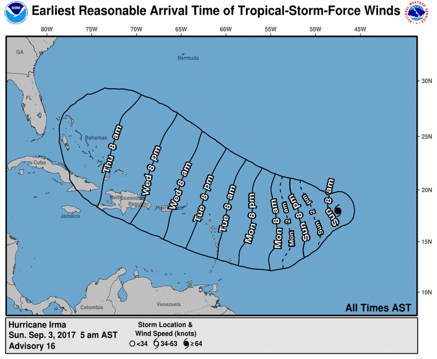
Here is when we can expect to see the impacts of Hurricane Irma:
And here is this morning’s key point from the National Hurricane Center:
Irma is expected to be a major hurricane when it moves closer to
the Lesser Antilles over the next few days, producing rough surf and
rip currents.  Irma could also cause dangerous wind, storm surge,
and rainfall impacts on some islands, although it is too soon to
specify where and when those hazards could occur.  Residents in the
Lesser Antilles should monitor the progress of Irma through the
weekend and listen to any advice given by local officials.
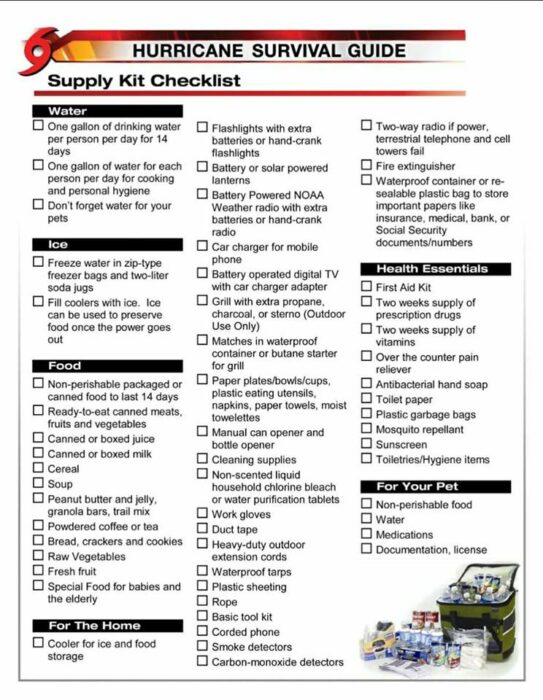
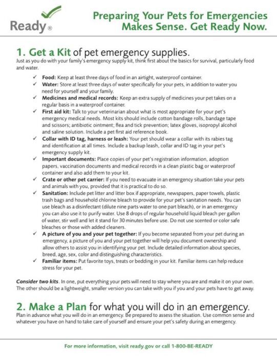
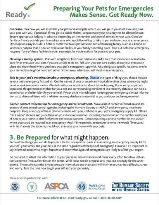
Here are a few items we posted yesterday that can help you prepare:



































Hurricane Marilyn was much stronger than a category two hurricane.
I’m going on the official report from the National Hurricane Center.
We were there staying in a house on North Shore
above Hawks Nest Beach
I don`t know what category it was ,bit we were fortunate to live through it. We got drinking water direct f Rom the cistern, raided th Weston ice machines and eventually made it to Tortola where.we got a flight to San Juan and on to Boston!!!
Can anyone tell me how coral bay made out I have family there and I am waiting anxiously to find out how they are.
Family in coral bay. Lost contact at 10am. If any news please post
All of the coral bay people are ok!!!!!!! No one died on STJ either so don’t worry!
How did you get in touch with people in Coral Bay?
I have a son in Coral Bay. There has been no communication. Are you in Coral Bay?
Same here. I’ve been searching the internet and this is the closest I’ve found to anything about St John. Wish I knew where else to check. The lack of communication if maddening! 🙁
Hoping it passes more to the north and you all remain safe
Being here for Marilyn can confirm Marilyn was a solid 3 and reports were that wind speeds were up to 140 on St Thomas bringing her in to a Cat 4
Hurricane Hugo, Sept. 1989, was Cat. 5 briefly, then got into the islands and became Cat. 4.
The eye went over St. Croix and Viequez, yet it did great damage to St. John.
http://noaa.maps.arcgis.com/apps/StorytellingTextLegend/index.html?appid=339405fe282446b1a0428999b08c1b62
Praying for you, Jenn, & our beloved little Paradise.
Does anyone know a very tall guy called Kaja or Kaia who lives or used to live on St. John? He just be between 40-50 years old now.
Has anyone heard how soon or anyway to send supplies to St. John?
We have friends in upper Peter Bay. How has that faired. Is there widespread destruction.
All our prayers are for a complete recovery. God bless