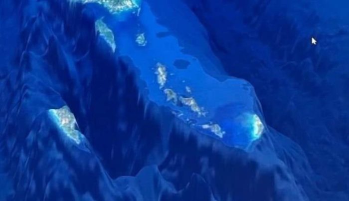
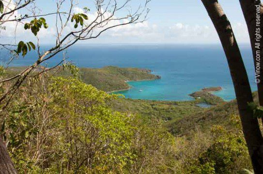
There has been an absolutely incredible aerial photo of the Greater Antilles Islands and the Virgin Islands circulating around the internet for the past week or so. It is absolutely amazing to see the perspective of our beloved islands from space and the depths of the waters surrounding us. So, curiosity got the better of me as I dove down the research rabbit hole of exactly what I was looking at in this captivating imagery….
Ok, so below is the image I am referencing. I will tell you in advance, you will get a much better perspective of the detailed imagery if you view it on a desktop or laptop rather than your cell phone. Also, I have searched and searched online to find the source of the image and cannot, for the life of me, figure out where the original came from. So, if anyone has a guess as to that, I’m all ears!
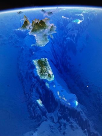
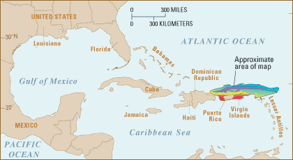
I did locate a similar image on the National Geographic maps website. So that you can get a better idea of what you are looking at!
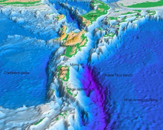
The mountains of Hispaniola (Dominican Republic and Haiti) are at the top of the image above with Puerto Rico just below them and the Virgin Islands in the lower part of the photo. St. Croix is all by her lonesome self to the left of the cluster of the BVI and USVI.
Ok, so I think a couple of things are important (and interesting!) to note here. First, the mountains of Hispaniola are towering, altitude-wise, over the heights of Puerto Rico and the rest of the island chain. The highest point on Puerto Rico is Cerro de Punta, or simply Cerro Punta, is located centrally on our MUCH larger Spanish sister to the north and towers to 4,390 feet above sea level.
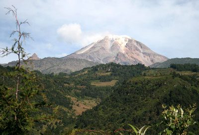
But, the HIGHEST peak in the West Indies is located in the Dominican Republic!
Duarte Peak, originally known as Mount Loma Tina and then as Trujillo Peak, rises to 10,417 feet (3,175 m); it is thus the highest peak in the West Indies. The rugged, heavily forested slopes of the cordillera have defied all but a few attempts to build through highways. Settlement is sparse.- Britannica.com
But, Puerto Rico has some lower depths worth chatting about as we look at this image. The Puerto Rico Trench, to the right of the island chain (in the photo) and spans all the way from Hispaniola to west of Anegada, is the DEEPEST part of the Atlantic Ocean AND the Caribbean Sea! The trench, located north of Puerto Rico on the geographical line where the Atlantic meets the Caribbean, is 27,480 feet at its darkest depth. That’s five miles below sea level. Crazy right??
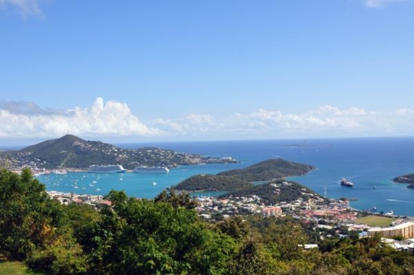
So, let’s bring all of this info back to our home in the Virgin Islands. To give you some perspective of these towering heights and depths listed above, the highest point in the US Virgin Islands is Crown Mountain on St. Thomas. The elevation? Only 1,555 feet above sea level!
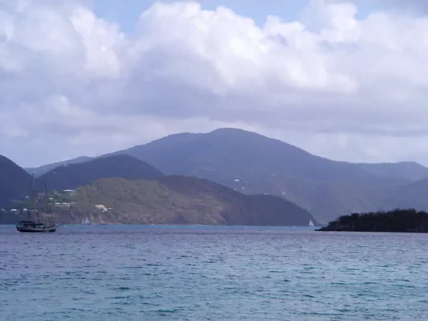
And, that seemingly towering mountain on Tortola that sometimes hides in the clouds is Mount Sage and is only 1,710 feet in altitude.
Meanwhile, on St. John, our highest peak is…You guessed it! Bordeaux Mountain, which tops out at 1,277 feet above sea level, is located between Centerline Road and Coral Bay. The strenuous Bordeaux Mountain hiking trail will get you nearly to the top from Little Lameshur. But, the trail is exposed to the sun and a whopping 1200 feet in elevation gain in one mile! So, if you plan to hit the trail, take lots of water, some good shoes and be prepared for a steady uphill climb with lots of great views before you head back down for some snorkeling and fun in the sun on the beach at Lameshur!
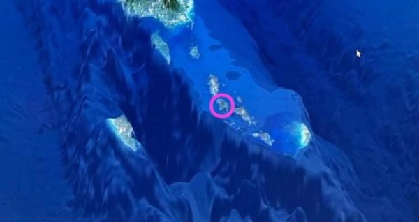
Ok, now let’s take a look at the depths of the sea between STT/STJ/Water Island and St. Croix. See that dark patch in the middle of the four US Virgin Islands?
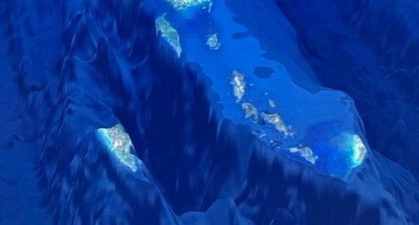
That’s referred to locally as the South Drop. A popular destination for fishing charters and local fishermen in search of blue water catches such as Mahi, Tuna and Wahoo. The South Drop is just a few miles south of St. Thomas and reaches depths of 12,000 feet at it’s lowest point. So, less than half the depth of the Puerto Rico Trench!
I hope that all of you have enjoyed this little geography lesson this morning 🙂 I couldn’t help myself from sharing the wealth of information presented in this ONE captivating photo. A photo that really puts an incredible perspective on how small this beautiful little rock really is in comparison to our sister islands!
Thank you for sharing this. Incredibly interesting stuff!
Excellent revelation and extraordinary photos not shown elsewhere.
I’ve been trying to find the source of that photo, too. Even asked Dr. Edie Widder but she didn’t know either. Interesting article.
Absolutely stunning geography! Thanks for sharing!!
Dizzying just to read this article! Thank you for your wonderfully informative and upbeat newsletter!