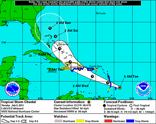
Tropical Storm Chantal is churning up the Caribbean Sea and moving quickly, but it looks like St. John will be spared a direct hit.
As of this morning (6 a.m.), the storm was about 520 southeast of St. Croix with maximum winds of 50 mph. According to the National Weather Service, Tropical Storm Chantal is expected to move west-northwest over the next 24-36 hours. Rain and squalls will begin affecting St. John and the surrounding areas this evening and into Wednesday.
The good news if that hurricane conditions are very unlikely to occur with this storm. The bad news is that the storm is expected to strengthen a bit as it moves closer. That means the threat of sustained high winds will increase as the storms nears, although they are expected to stay under tropical storm force. A storm surge is not expected, but tides on the south and east coasts are expected to be one to two feel about normal.
What does this mean for St. John? Well, the system has the potential to bring flooding rains to the area and high wind gusts. That means it’s time to bring your pets inside, secure your boats and put away any of those items outside that you would really miss should they blow away. For the tourists on the island, it means you should probably hunker down at the nearest bar, preferably with a Bushwacker in hand.
In all seriousness my tourists friends and locals alike, it seems as if this is going to be a windy, rain event. For the latest on Tropical Storm Chantel, please check out any of these websites:
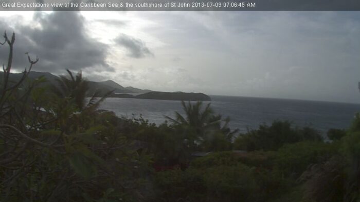
If you’d like to see live conditions of what’s happening in St. John, please check out Great Expectation’s webcam, which provides a great view of the south shore. You can find that webcam here.
This image was captured this morning: