Tropical Storm Dorian formed over the weekend, and it’s something that we need to keep an eye on. Although it does appear that it will continue tracking to the south of St. John and the entire US Virgin Islands.
According to the National Hurricane Center’s 8 a.m. update this morning, Tropical Storm Dorian has maximum sustained winds of up to 60 miles per hour. No watches or warnings have been issued for the USVI at this point. The National Hurricane Center stated “while it is too soon to determine the specific time or magnitude of possible direct impacts in Puerto Rico, the Virgin Island or Hispaniola, interests in those areas should monitor the progress of Dorian and watches could be required later today.”
As you can see below, all of the Monday morning spaghetti models have Dorian tracking south of St. John.

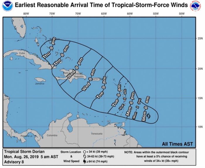
Here is the expected arrival time of winds as of Monday morning:
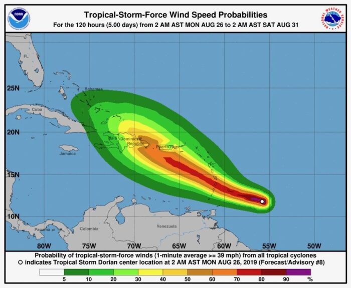
And here are the expected wind speed probabilities as of Monday morning:
As of this morning, none of the major airlines have issued fee waivers due to the storm.
As with all storms, the track and intensity can change at anytime. This is something that we should all continue to keep an eye on.
Visited St. John for the first time in May and fell in love with the beautiful island and it’s amazing people. I’m coming back in mid Sep for just a few days. Watching the weather closely and I’m coming no matter what. If there is damage and I need to help with cleanup I’m happy to do it. Stay safe friends!
Due there in 2 weeks, watching closely also.